This is a new technology we are going to use in a wind farm we are going to build in Chile.
The area that we need is too small to make LIDAR topography cost effective, but too big to use standard field topography: with this new solution we can have the needed data for a reasonable price.
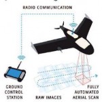
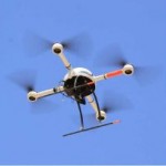
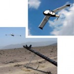
The vehicle comes in 2 shapes: airplane like (fixed wing) and helicopter like (rotatory wing). The fixed wing plane is launched with a sling.
The vehicle weight around 3 kilos, and it can fly for about 1 hour at a height of a couple hundred meters, with a speed of about 75 Km/h.
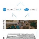
It is possible to obtain several useful outputs:
- Cartography
- Digital Model of the Terrain
- Aerial pictures
- Thermography
- Multispectral images
- Video
It normally flies alone without any input, but it can be used with a remote control as well.
The main advantage is that it is clearly cheaper: you don’t need to book a flight, wait for a days without clouds (because you can fly lower) and it’s quick and safe.


Leave a Reply